Land & Survey
MON-SAT 8:00 am - 5:00 pm
(+237) 679 643 780
Company Profile
Company Brochure
Start With the Right Information
Whether you are buying land, planning a development, or preparing for construction, Ngwang Corp provides the accurate ground data you need to move forward confidently.
Contact our team with your land details, and we’ll guide you through the survey process with clarity and professionalism.

Land & Survey
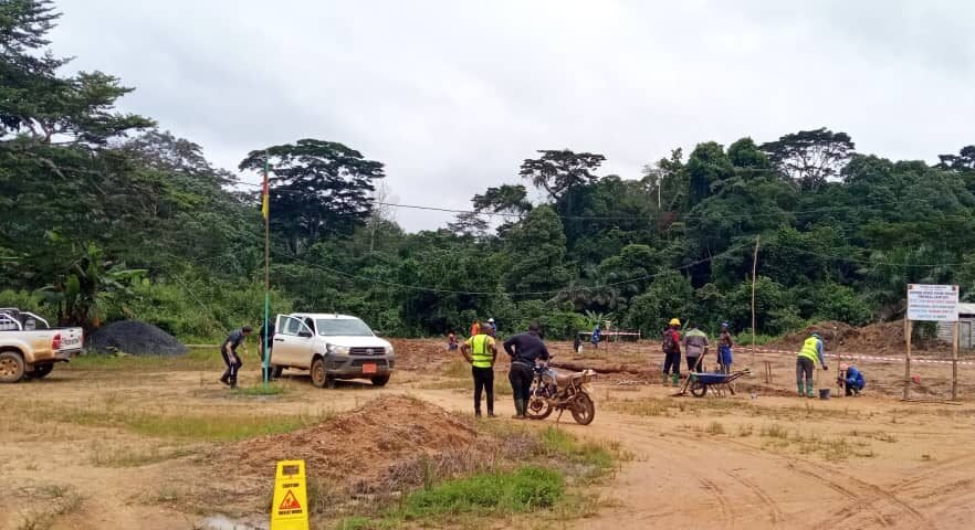
Ngwang Corp’s Design & Construction service is built on a simple principle: great projects start with smart planning and end with solid execution. We handle your project from concept to completion, blending architectural creativity with engineering precision to deliver structures that perform and last.
Whether you’re developing a residential property, a commercial facility, or a large-scale infrastructure project, our team brings together designers, engineers, and construction specialists who work in sync to build exactly what you envision — safely, efficiently, and cost-effectively
Our Land & Survey Services Include
Topographic Surveys
Detailed mapping of land features, elevations, and natural conditions to support planning and engineering design.Boundary & Cadastral Surveys
Accurate boundary identification and verification to ensure legal clarity and prevent land disputes.Site Evaluation & Feasibility Studies
Assessment of soil conditions, access, drainage, and terrain suitability for construction or development.Setting Out & Construction Surveys
Precise marking and alignment of structures to ensure buildings and infrastructure are executed exactly as designed.Road & Infrastructure Surveys
Survey support for roadworks, drainage systems, and large-scale civil engineering projects.Regulatory & Documentation Support
Preparation of survey reports and documents required for approvals and land administration processes.
Why Clients Trust Ngwang Corp for Land & Survey
- High-Accuracy Equipment & Methods - We use modern surveying tools to deliver precise, dependable results.
- Integrated With Design & Construction - Survey data flows directly into our engineering and architectural teams, reducing errors and delays.
- Strong Knowledge of Local Land Systems - Our experience in Cameroon helps clients navigate land processes with confidence.
- Risk Reduction From Day One - Accurate surveys prevent costly corrections and legal complications later.